Howden Rural District Guide 1971
Howden Rural District
History
The Parishes
Useful Information

Howden Rural District
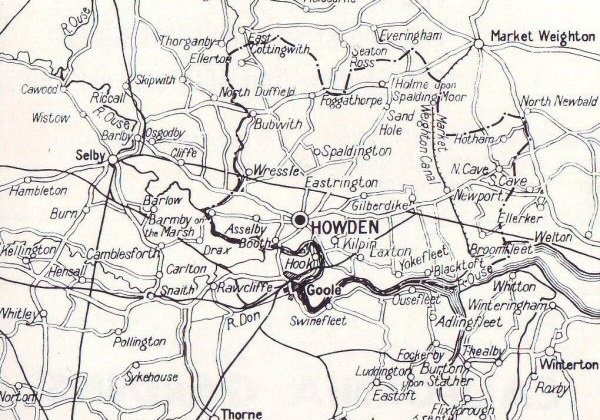
The district is roughly bounded by the Yorkshire Wolds on the north and east, and on the south and west by the Ouse (here widening to the Humber) and the Yorkshire Derwent, respectively. It is thus a natural, geographical unit.
Today, future development is bound to be affected by the plans for Humberside, where much new industry and improvement to the ports is envisaged, which would, of course, bring a large increase in population to the villages of the area. At present, though of course many of its people work in Goole and in the established Humberside industries, it is a farming district with a farming district's problems. The land is deep and fertile, able to support heavy cropping and stocking, but the prevailing difficulty is the gap between the producer and the consumer. For instance, though flowers are always a luxury to buy, here, as over large areas of Lincolnshire across the Ouse, it has sometimes proved impossible at market prices to cover the pay of the pickers, and so growers have turned to selling bulbs instead of blossoms. Being descended from the Vikings, the local people are daring and adaptable, however, and will rise to any challenge. Old farmhouses have been modernised, not for week-end occupants or hobby-farmers, but for the descendants of those who built them; and grain-driers, intensive stock units, milking parlours, etc., installed. What is wanted by the consumer is being and will be produced.
The district, to the visitor, with its low-lying fields and continuous hum of tractors, may seem placid - what old-fashioned guide books call "a haunt of rural peace". The inhabitants know that it is a "haunt" of hard work and enterprise!

History
The place-names of the District are generally speaking its oldest feature, far in prehistoric times much of the land was marshy and in part thickly wooded as well. The Saxons and Scandinavians, however, were used to these conditions and had developed heavy axes and a heavy plough; also they used the waterways as highways. Here, therefore, they settled. Domesday Book lists the particulars of the villages, the land under the plough and that lying waste, with the names of the landowners. But it must be remembered that Domesday Book was compiled some twenty years after the Norman Conquest, and during that time the conquerors had laid waste a great part of the North, which had not readily submitted to Norman rule.
The great number of moated sites in the area does not necessarily point to fear of aggression - moats were used for drainage, fire precautions, stocking fish, and several other purposes besides defence. There were one or two castles, mostly commanding river crossings, and two medieval religious foundations, the Gilbertine priory at Ellerton and the collegiate establishment for secular clerks at Howden, founded by the Bishop of Durham in 1266.
Again in 1536 the people resisted tyranny, for Robert Aske, leader of the Pilgrimage of Grace, was a man of Aughton in Ellerton parish. During the Civil War, the district was Royalist, this allegiance resulting in damage to Howden Church and the slighting of Wressle Castle by the Parliamentarians.
Since then the history of the district has been largely that of its enclosure, drainage, changes of ownership, cropping agriculture and techniques. As a residential area for those working outside its boundaries it has proved attractive, and some pleasant private houses have been built as also, since the 1939-45 war, 650 built by the Council. Some of the enterprises of the past - such as the Market Weighton Canal - have fallen into disuse, but in general the district's history has been one of quiet and steady progress.
The Parishes
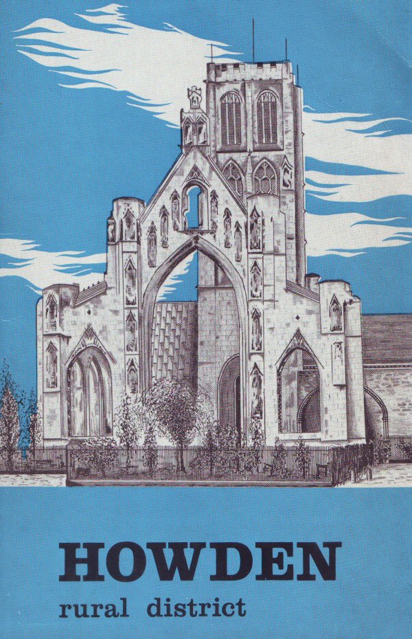
Howden, the administrative centre of the district, is a small town notable for its fine church, and formerly as a seat of the prince bishops of Durham. The prebendary college, of which the church was part, was founded in 1266; much of the present church and of "Skirlaw Palace" was constructed or improved by the direction Of Walter Skirlaw, Bishop of Durham 1388-1405. (The actual college was demolished in 1850.) On the intellectual side, probably the most remarkable native of Howden was the 12th century historian, Roger de Hoveden.
But Howden has another claim to fame - it was for centuries the site of an international trade fair, as important to the commerce and mobility of a horse-drawn world as a combination of a motor show and one of armed fighting vehicles would be today. Chartered by the bishop, the Howden Horse Fair begun on 26th September and lasted six days; in medieval times it was one of the largest in Europe, and even towards its nineteenth-century decline, probably the largest in England.
The comings and goings of the Bishop's court and of the horse-copers resulted in there being a great number of inns, the company at which must have been very contrasting and assorted. A romantic story connected with the horse fair is that of Baron Ward, who, as a stable-boy, went with some horses purchased at the fair to the Duke of Palma-Medina and in due course rose to be his prime minister.
There used to be a great cattle and horse fair also for three days beginning April 15th, and a cattle and trading fair on 2nd October; not to mention courts leet and baron held in the old Bishop's Palace, a Saturday market, and cattle-markets every other Tuesday. But of all the doings of the old days, only the inns now remain, providing excellent car-parking in their spacious yards and former stables.
It should be explained that the church used for worship today is the nave of the original, the chancel and beautiful octagonal chapter-house being in ruins. This nave, the present church, is in the Decorated style with a modern roof. Part of the transept is Early English and so is the earliest part of the building remaining. In the south transept is the Saltmarshe chapel. The present chancel was contrived from the space under the tower, where the former rood-screen serves as a reredos and covers the entrance to the original chancel. Late Perpendicular in style, the lower part of the tower is original, the upper part a rebuilding of 1929 after a fire. At that time, too, the heavy and melodious bells were re-cast.
Not far from the church, in Ashes Park, is a large stone house into which is built much of the original Bishop's Palace. In the park, once the palace pleasure grounds, is also an interesting stone chamber built on an arch spanning the moat.
Ashes Park was given to the district by Mr. Charles Briggs, of a local brewing family. It contains fine trees and floral displays, especially roses; cricket and football pitches, tennis courts, a green and a children's playground. It is also the site for the annual show of the Howdenshire Agricultural and Horticultural Society, particularly well-known for its floral section and one of the largest one-day shows in the Riding.
There are more memories than conspicuous remains of the past in Howden - the grammar school founded by Bishop Skirlaw was closed in 1927 and apart from the church and palace the only relics of long ago are a gateway in the vicarage garden, bearing the arms of Cardinal Langley, and some domestic buildings, including the gracious Georgian Howden Hall.


Derwent Side.....
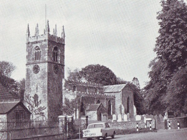
Ellerton is the northernmost parish, the village being long and scattered with the site of the priory towards the river. This priory was founded some time before 1212 by William Fitz-Piers. Up to the 19th century the nave of the priory church was used by the parish but being "much dilapidated", a new building of the Decorated style was erected, which still some contains slight remains of the original. Sir Hugh Bethell founded six almshouses here in 1610. At Aughton, within the parish, there is an interesting church partly rebuilt in the 19th century: the tower was erected by order of Christopher, the son of Robert Aske, leader of the Pilgrimage of Grace. There is a 15th century Aske brass. The "tump" near the church is the site of the family's fortified dwelling: earthworks near the river show the site of an earlier castle.
Bubwith village stands on the bank of the Derwent which is crossed by a ten-arched bridge. Up to the 19th century the village had a corn market. The church, on the river bank, is of Norman Origin and the chancel arch of that time remains, the rest of the building being Early English and Perpendicular. Gunby and Breighton, also riverbank settlements, are in the parish further south.
Nicolas de Bubwith, bishop of Bath and Wells, 1407-1424, was a native of the parish.
Wressle claims the only fortified building still standing in the East Riding - its castle; strictly speaking a castellated mansion, built long after the great years of castle building by Thomas Percy, Earl of Worcester, beheaded after the Battle of Shrewsbury. It was occupied until the Civil War and afterwards slighted, but although still further damaged by fire in 1796, the south side of the original quadrangle and two towers remain. The fire destroyed the castle chapel which was used as the parish church and three years later the present brick building was erected on an earlier site. Formerly there was a windmill at Wressle. There is a bridge south of the village.
Barmby-On-The-Marsh is in the between the Derwent and the Ouse. The village is large but compact, largely because when the enclosures took place, the farmers did not move out to live on the new lands, which were liable to flood but retained their houses in the village. Tradition says that William the Conqueror parted Barmby among forty of his soldiers, who probably preferred to settle closely, for safety, in the first place. St. Helen's church is said to have been altered from, or built on the site of the medieval tithe-barn; the nave is Perpendicular.
Barmby was once a river-port with wharves and a sailcloth industry, and something of a resort, with a race-meeting, held in June, and two medicinal springs, St. Peter's and St. Helen's wells.


Along the Ouse.....
Asselby, between Howden and Barmby, has an "island" without the dykes that contain the Ouse, really a promontory that was once an island. Knedlington, in the parish, has a Tudor Old Hall and later Manor, and is rather picturesque. Booth, by the bridge that leads to Goole, is partly in this and partly in Howden parish. It was in fact at Booth Ferry House, part of which was then an inn and which stands just across the river from Booth, that in 1822 the contract for cutting Goole Docks was signed.
Kilpin is itself a fairly small village; but the parish includes Kilpin Pike and Skelton, along the river bank opposite Goole, with a certain amount of industrial developments, as well as residential development. The land here (as indeed in the parish of Asselby) is very fertile and well-farmed. Sandhall, directly opposite Goole, was the home of several prominent families during the Middle Ages.
Laxton village is a pleasant one with a 19th century "Decorated" church, and the chancel of the old church nearby. There is a very old oak in the grounds at Metham Hall. The parish includes Saltmarshe; there is a road through the grounds of Saltmarshe Hall which extend along the bank of the Ouse.
Blacktoft is about a mile above the junction of the Trent with the Ouse, and is right on the bank. It has a "neat, substantial" church rebuilt in 1841 and improved in 1904. It might have become the port that Goole is now: during James I's reign there was a great scheme for cutting a canal from Blacktoft to Water Fulford on the outskirts of York and a survey was made; but the plan was abandoned. The river here contains wide sandbanks, as it does even wider ones further down; therefore boats wait at Blacktoft for the tides.
The agricultural system called "drowning" in the south, and "warping" here, was practised up to quite a late period and accounts for various banks and drains about the parish. The river was allowed to flow over selected land (on which no rent was paid that year) and deposit fertile silt: the next year it was shut out, and double rents were due! There are extensive brick and tile works inland, beside the disused Market Weighton canal.
Broomfleet was the scene of some interesting reclamation work half a century ago, when Broomfleet Island was reclaimed from the Humber and joined to the mainland. Here the sandbanks and low-lying land are visited in winter by thousands of wild geese. The settlement, and the church, which was built in 1861, are a little inland.


At the Foot of the Wolds.....
North Cave is in this position and the village is a large one. The handsome church is partly Transitional but mainly Decorated and Perpendicular, and contains monuments to the Metham family who were once lords of the Manor. Road A1034 here runs northward on a Roman foundation.
Hotham adjoins North Cave, with the parklands Of Hotham Hall between the villages. Here, too, the former Roman road runs east of the village. The ancient church of St. Oswald was very much restored in the early part Of this century, but retains several old features including a Norman arch and tower.
Central Parishes.....
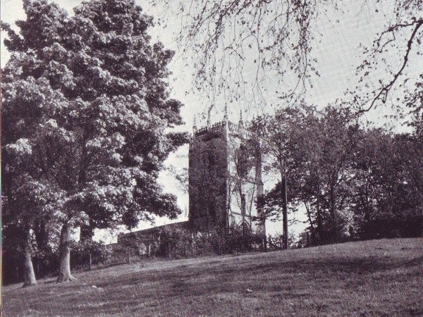
Holme On Spalding Moor is said to be the largest parish, in area, in England. The village is on the main Selby to Market Weighton road and lies at the foot of a small hill. On the hill top stands the much restored but dignified Perpendicular church with its fine tower; there was formerly a beacon on this hill. East of the village is Holme Hall, long the home Of the Roman Catholic Staunton family, now occupied as a convent. The parish had two geological oddities: earthquakes were felt, of some severity for England, in 1822 and 1833; and in nearby gypsum beds were found large quantities of ammonites.
Foggathorpe village is west of Holme on the same road. It was called Fulcathorpe in Domesday Book and was given by William the Conqueror to his standard bearer Gilbert Tison. There was once a moated mansion here belonging to the Ackroyds; although it was demolished in 1743, the moated site remains.
Eastrington, some five miles south of Holme, has had brickworks within the parish in the past. The church is Early English and Perpendicular in style but with some traces of Norman work: it contains an effigy of a Knight Templar.
Gilberdyke village is on the road from Howden to North Cave. It, too, has been a brick-working parish. Walling Fen, an excellent area of cultivation, is shared with
Newport, which stands where the disused Market Weighton canal is crossed by the main road from Howden to Hull. In the 18th century the area was "an uncultivated morass", but the discovery of brick-earth resulted in the building of a new village with canal facilities for shipping bricks. At the end of the 19th century the church Of St. Stephen was built, having a tower with a short steeple.
Spaldington, four miles north of Howden, is an isolated village with extensive common-land. Characteristic of the district, the Elizabethan hall was demolished in 1838 at the period when yeoman-farming followed the parcelling out of big estates or, alternatively, landowners, themselves growing more prosperous, built new residences to take the place of ancestral halls.
Useful Information
Administration: Howden Rural District Council. Thirty members represent the eighteen parishes.
Area:
69,963 acres
Banks:
- Midland Bank Ltd, Howden. Sub-branches at Bubwith, Newport and North Cave
- Westminster Bank Ltd, Howden
- Barclays Bank Ltd. Sub-branch at Holme on Spalding Moor
- Lloyds Bank Ltd. Sub-branch at Holme on Spalding Moor
Council Meetings:
The Council meets at Hailgate House, Howden, on the Friday of every fourth week.
Council Offices:
Hailgate House, Howden (Telephone: Howden 286). John Green, LL.B., Clerk of the Council, 14 St. John Street, Howden (Telephone: Howden 209).
Local Newspaper:
Howdenshire Gazette. Published on Friday, price 4d.
Parliamentary Constituency:
Howden. Member Of Parliament, Mr. Paul Bryan (Cons.)
Population:
12,300.
Public Utilities:
- Electricity: Yorkshire Electricity Board.
- Gas (in Howden): North Eastern Gas Board.
- Water: East Yorkshire (Wolds Area) Water Board.
Rateable Value:
£240,562
Rates In £:
9/4d.
Council
- Chairman: Mr. J. Hewson, 30 Thorpe Road, Howden.
- Vice-Chairman: Mr. G. B. Wright, Lingwood House, Holme-on- Spalding
Chief Officers:
- Clerk and Solicitor: John Green, LL.B.
- Medical Officer Of Health: Dr. W. Wilson.
- Senior Public Health Inspector and Surveyor: A. G. Orme.
- Treasurer: W. Hallam.