Boothferry Guide 1978
Civic Insignia
Foreword
Round the Towns: Goole - Howden - Snaith - Epworth
Drainage and Reclamation
Round the Villages
Recreation
Industry
General Information

Civic Insignia
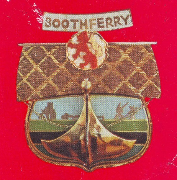
The composition of the Mayor's Badge, which is worn with the twenty-six link gold chain from Howden Rural District Council, represents those factors to all parts of Boothferry, but at the same time reflects particular features of each part.
The unusual form - the prow of a Viking ship in full sail - is in yellow and white gold and emphasises the dominance of the six great rivers of the district: the Ouse, Trent, Don, Aire, Idle and Derwent; while the background shows four colours, blue for the rivers, brown for the rich soil, green for the crops, and the light blue of the wide skies typical of this part of England.
On the skyline are shown in profile the bridge which replaced the ferry at Booth, after which the Borough is named; a windmill; a derrick to symbolise Goole town and docks, and the Minster church of Howden.
The sail of the ship displays the White Rose of York, charged with the red Lion rampant of Mowbray, showing the joining together of Yorkshire with the Isle of Axholme in Lindsey.
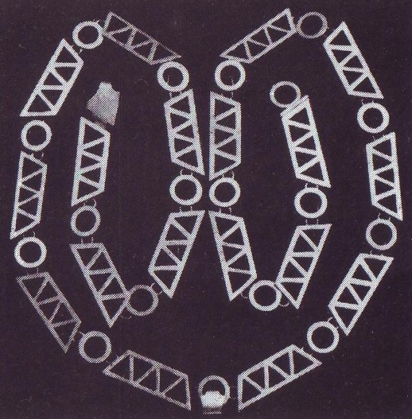
The medallion of the Mayoress complements the Mayor's Badge. The design of the chain is based on Viking originals, the motifs which comprise it found in Viking art on jewellery and weapons. The treatment of these motifs, however, and the style and workmanship belong to the 1970s. A Viking longship is displayed from a side view with three roundels, two above and one below the longship. Each roundel displays one of the symbols which also on the Mayor's Badge; namely the White Rose, the Mowbray Lion and the images of the Minster, port, windmill and bridge silhouetted against the blue sky.
Both pieces were designed and executed by Mesrs. K. Padley and W. Walker of the Loughborough College of Art, and the Mayoress' insignia was provided by public subscription.
The Badges for the Deputy Mayor and Mayoress show the Rose and rampant Lion motif of in white, green, red and gold.
Foreword
In May 1978 H.M. Queen Elizabeth II was graciously pleased to grant a Charter conferring borough status on the former District of Boothferry and I was accorded the great honour of being elected its first Mayor. It is in this capacity that I am further honoured to have been asked to write the foreword to this official guide for Boothferry Borough.
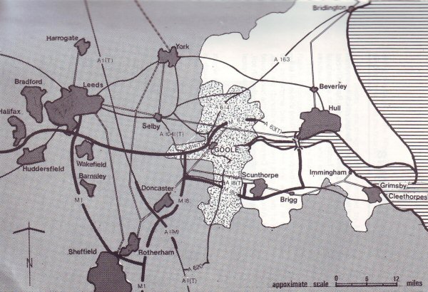
Boothferry incorporates the town of Goole (formerly a municipal borough) and the rural areas of Goole district, Howdenshire and the Isle of Axholme, and forms the western part of the new County of Humberside. It is centred on the Town and Port of Goole and extends fromn the edge of the Yorkshire Wolds at Holme-upon-Spalding Moor southwards to the bed of the River Trent at Owston Ferry. It also stretches westward beyond Snaith and to the east as far as King George V Bridge (more popularly, though quite erroneously, known as Keadby Bridge). Its total area comprises 250 square miles.
Five rivers form the key features of the area covered by the Borough, which consists mainly of rich and fertile agricultural land including what is perhaps some of the most productive land in the country. Some industrial development is currently taking place around the town and port of Goole, which can claim to be the furthest inland port on the east coast and also one of the largest inland ports in the country. Its frequent services to the Continent provide an ideal and economical outlet for exports to the Common Market countries from the highly industrialized areas of Yorkshire and Lancashire, which are well connected by the recently completed M62 motorway, by rail and by inland waterways.
In the southern part of the Borough, an industrial estate is being developed on what was formerly the Sandtoft Airfield in the Isle of Axholme, and already industrial developers are showing interest in the facilities offered in that area. The forthcoming completion of the M180 motorway with its new bridge over the River Trent is confidently expected to greatly enhance the success of that project.
In commending this first edition of the Boothferry Borough Guide to visitors and inhabitants of the Borough I would emphasize the enormous potential of the Borough, particularly for industrial development. Its geographical position together with its excellent transportation facilities make Boothferry ideal for expansion.
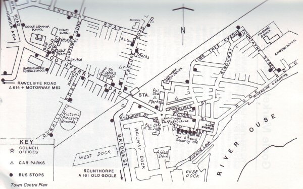
The Town and Port of Goole
(by Frank Atkinson, O.B.E.)
A visitor travelling along the M62 motorway towards intersection No. 36 will see to the south a compact handy-sized town with a skyline of spires, water towers and dock cranes. Although it can boast a few industrial chimneys, there is very little industrial haze in the atmosphere. It is noticeable that it is surrounded by a spacious and tidy countryside typical of the farming community. It is also river country, with the lower Ouse winding its way through the countryside in big loops.

The exit from the M62 at intersection 36 brings a road traveller almost into Goole. On his immediate right is the M62 Industrial Estate, and about half a mile further, he is in Boothferry Road with its tree-lined approach and vista leading past the attractive facade of the Grammar School on the left-hand side. Its straight length extends for nearly a mile over the railway crossing to the roundabout in the centre of the town. This initial entry is pleasing, but exploration will quickly show that this modest little town has most of the amenities required today - schools, hospitals, a library, and a fine market hall backed up by a busy and colourful open market. It is a busy shopping centre. Goole has swimming baths, a recreation ground, parks and public gardens, and there are constant efforts to expand the recreational facilities of the Town.
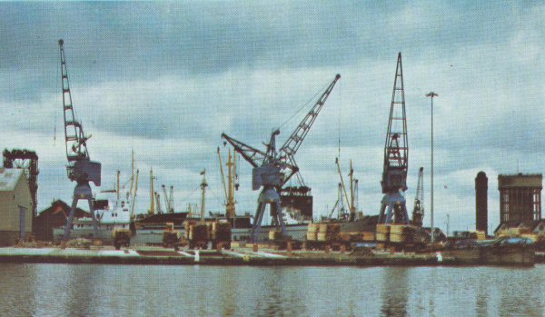
One is reminded of many a small town in Northern Europe; the whole has a slightly Continental look and the plethora of cyclists adds to this impression. This is even more emphasised when the visitor, continuing still further past the roundabout, finds himself on the banks of the Ouse at the point known locally as the Lock Hill. On his left side is a view of a tree-lined road, pleasant houses and gardens. One might be looking at Arnhem or any town on the Rhine. On his right side is a view of docks, cranes, warehouses, locks and a shipyard. !t is this blend of countryside and industry which gives Goole its unique European character. For it is a purpose-built town intended, as a gateway to the Continent, and indeed in former times the streets of Antwerp, Bruges and Ghent were as familiar to many Goole people as its own surrounding countryside.
In 1976 the Town and Port of Goole completed 150 years of existence and activity. It is interesting to recall that Goole was founded for a specific purpose, yet unforeeen developments made it the town it is today. When, at the beginning of the last century the "Undertakers of the Aire and Calder Navigation" built their Leeds to Goole canal system, they visualised Goole as the terminal and point of access to the River Ouse and nothing more. !n those early days there was only a cluster of houses in the vicinity. It was soon apparent, however, that the activities of Goole could not be confined to this limited function. A dock system was gradually developed to accommodate seagoing vessels, and Goole became, and has continued to be, a busy Seaport. In addition to the canal system, Goole was linked up by the railway which provided further communications with the expanding industrial West Riding of Yorkshire. Today, therefore, it is a strategically-placed commercial and industrial centre but always influenced by the activities of the busy seaport which forms an integral part.
Two interesting factors of geographical importance might be mentioned. Many visitors are surprised at the size of the River Ouse as a navigable river 50/60 miles from the sea. In this connection it should be borne in mind that the waters of the great Yorkshire watershed - from the Swale, Ure, Wharfe, Calder, Aire and Derwent drain directly or indirectly into the lower Ouse and pass the "front door" of the town and port of Goole. The second point is that Goole is an up-river port facing towards the Continent. Now that Britain has joined the E.E.C., Goole is more than ever a natural gateway to Europe.
Up to the 1939/45 War, it could be said that the shipment and export of coal was the outstanding activity of the port, and an interesting feature developed in this respect, arising from the canal link with the collieries twenty miles to the west. A system was specifically devised for bringing coal down the canal in floating compartments, known locally as "Tom Puddings" of 35/40 tons each. Special coal hoists were built in the Goole Docks, which could lift the compartments on a cradle and tip them, emptying the coal down a chute into a sea-going vessel alongside. This system was peculiar to the Port of Goole. A sight on the canal was a "train" of compartments being towed down the canal through the countryside. It meant that the sea-going ships carrying the export coal could rely upon a quick turn round in port - a factor of paramount importance for a competitive up-river port. Coal hoists were built to handle railborne coal for shipment in a similar way. There was no other port in the United Kingdom, therefore, which had quite the same facilities as Goole, of being able to load coal by two separate and distinct methods; both of them being highly efficient. "Goole" coal found its way, therefore, to most near-Continental destinations, especially to Belgium.
Apart from the coal trade, regular shipping services were established between Goole and a whole range of Continental ports from Copenhagen to Boulogne, for the shipment of general cargo. These regular services were operated by local Liner Companies, notably the Goole Steam Shipping Company (owned and operated by the Lancashire and Yorkshire Railway - subsequently to become part of the London Midland & Scottish Railway), also the Bennett Steamship Company (now absorbed by the P&O group). A considerable proportion of the coal shipments was carried by ships owned by local Tramp Shipping Companies, owned, managed, and financed by Goole people. In the early 1920's it was estimated that the combined fleets of local Liners and Tramp Vessels consisted of about 45 ships of various sizes. This meant that more than two thousand people were directly linked with this form of employment, either sea-going, or shore staff. Although Goole is many miles from the sea, there was quite a salty "tang" about its population.
Vessels sailing from Goole have to navigate more than 55 miles of navigable channel before they reach the open sea at Spurn Point. This navigable channel through the Lower Ouse and the Humber Estuary, which in turn has seen sailing vessels, steamships and now motorships, is marked and lighted throughout by an elaborate and comprehensive system of beacons, light floats and lightships.
Goole enjoyed its booms in trade, but it also suffered from its slumps. When there was a recession in trade, the Goole docks presented a depressing sight of local idle ships laid up for lack of cargo. Although such situations were the outcome of the vagaries of world trade, there were perhaps few Ports where it was brought home in such stark reality as to Goole and its seafaring community.
Those were days before modern aids to navigation were known, before the regular installation of wireless and the radio telephone were visualised. An overdue ship could not be anticipated and could be the cause of expensive disorganisation. A much overdue ship could give rise to anxieties and foreboding. A missing vessel would cause grief and tragedy. Goole has known all these.
Alongside this maritime activity was the growth of the local Shipbuilding and Repairing establishments, Chemical and Fertilizer processing, Flour Milling, Clothing Manufacture, Engineering, etc. Goole could claim quite rightly and proudly, that it was the eleventh Port in the United Kingdom and the most inland Port on the East Coast. Progress has been pioneered by a long-established Chamber of Commerce, together with a Chamber of Trade, and an active Junior Chamber.
The 1939/45 War brought most of Goole's activities as a port temporarily to a halt. After the war the remote control of the Aire and Calder Navigation was brought to an end and the dock system is now owned and operated by the British Transport Docks Board. A change in the general pattern of trade has seen the decline and gradual disappearance of the local ships. Goole was adapting itself to a changing situation.
The foregoing comments have outlined the growth of the Town and Port, mainly due to its excellent communications - Canal, River and Railway. But a new factor had gradually emerged, and following 1939/45 has become of ever greater importance, namely the rapid growth of road transport throughout the country, hence the development of the motorway system of modern roads. There was great satisfaction, therefore, when in May 1976 the final link in the completion of the M62 motorway took place, by the opening of the "Ouse Bridge". This magnificent structure, more than a mile in total length, carries the M62 over the River Ouse just above Goole. Intersection 36 on the outskirts of the town has ensured that Goole has direct and close access to the M62, and through it to the whole new network of motorways in Great Britain.
In the realm of local government, Goole was affected by the re-organisation of 1974. Goole had been a Municipal Borough at the eastern extremity of the former West Riding of Yorkshire, and its immediate neighbours were administered by Rural District Councils. Under the 1974 reorganisation, the new County of Humberside was carved out of Yorkshire and Lincolnshire to form the territory on the banks of the Humber Estuary and lower Ouse. This new County consists of nine districts - four on the north side, four on the south side, with the Borough of Boothferry at the "head of the river", astride both north and south banks. Boothferry, consisting of the former Goole municipal borough, and the former rural districts of Howden, Goole and the Isle of Axholme, is administered by the Borough Council of 35 members. Goole is the obvious administrative centre for this new local government organisation, not only because of its central geographical situation in the new borough, but also by reason of its former status as a municipal borough, and the facilities and expertise which went with it.
The past five years have been a period of adjustment, co-ordination and development from a local government point of view and in all spheres of commercial and industrial activity. The fact that Goole is the administrative centre of the Boothferry Borough emphasises its unique position, and the advantages it is able to offer. It has been said that modern industry and commerce depend more than ever upon efficient communications. Goole certainly has these in abundance. Unlike so many centres it is able to combine its very promising potential with the more-than-average advantage of four modern systems of communication - canal, sea, rail and road.
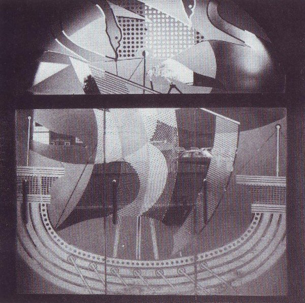
Goole Market Hall
The original blank, brick frontage of the Market Hall has been improved by the addition of features appropriate to its prominent position in the town centre. Large glass doors, etched with a design based on the ship and swans of the Goole coat of arms, are set in a recessed vault.
The plain facade is further enhanced by a ceramic coat of arms ten feet in diameter and a frieze, which also uses the ship and swan motif and incorporates the words GOOLE MARKET HALL in letters two feet high. The frieze is designed to echo the existing stone work on the side of the building and the glaze was chosen to harmonise and to avoid maintenance.
Prepared by York University Design Unit and painter John Langton, the project was carried out under the supervision of architect David Strickland. The doors were etched by Ellis Pearson Limited of Sheffield, and potter David Lloyd Jones made the ceramics.
Howden
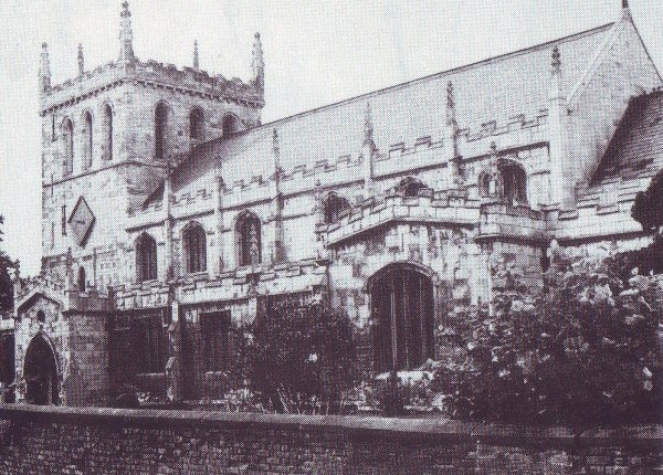
A small town of historic interest four miles from Goole, Howden, is one of four designated conservation areas within Boothferry.
First-mentioned in the Anglo Saxon Chronicles of 930, it is noted for its magnificent Minster, which was a seat of the Prince Bishops of Durham. The prebendary college for secular clerks, of which the church was part, was founded by Walter Skirlaw (Bishop of Durham 1388-1405).
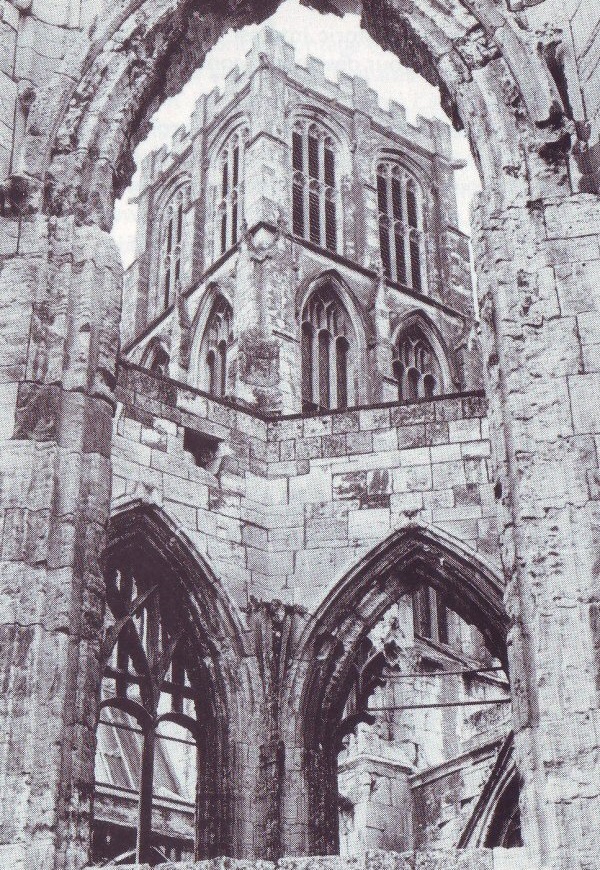
The Minster Church of St. Peter is the nave of the original structure and is mostly 14th century, but the ruins of the Chapter House and the Chancel can be seen from the Market Place.
Probably the most remarkable native of Howden was the 12th century historian Roger de Hoveden, confidant of Henry II and friend of Thomas Becket.
Past events include Courts Leet and Baron, held in the old Bishop's Palace (some traces of which are incorporated in the ruins of a large stone Manor House near the church); the Saturday Market, and a fortnightly Tuesday Cattle Market.
Howden was renowned for centuries as the site of an important Horse Fair which lasted for six days, beginning on 26 September. In medieval times it was one of the largest in Europe and even towards its decline in the 19th century, it was still probably one of the largest in England. The numerous inns, providing car-parking in their spacious yards and former stables, are remaining links with Howden's former importance.
Not far from the church is The Ashes Playing Field, which was given to the town by a local benefactor, Charles Briggs. It contains fine trees and floral displays, especially roses; provides playing field facilities, and is the venue for the annual Agricultural Show in August.
Howden Marsh is a low-lying area of 11.7 acres, the habitat of wild flowers, animals and birds which, in a bold venture, the Parish Council is developing as close to nature as possible. The Marsh has been drained and the water disciplined to form a lake, with small islands planted with trees for birds and other wild life. There is a grassy area suitable for picnics and seats are being provided. A hard-surfaced way, including part of the disused railway line, will surround the Marsh as a nature walk.
Private housing developments offer a variety of modern homes, and shopping and educational facilities serve the needs of local residents.
(population 2,720)
Snaith
An ancient chartered market town of narrow streets, eight miles to the west of Goole.
As a place of some importance, Snaith was listed in the Domesday survey and had its own ecclesiastical court.
The main feature of the town is the Priory Church of St. Laurence, dating from about 1250, although there is some earlier work. Of special interest are the statue of Viscount Downe (1837 by Sir Francis Chantrey); a slab which preserves the indent of a very large brass to an Abbot of Selby (circa 1559); the rood loft spiral staircase, and the Easter Sepulchre. The Parish registers date from 1537.
Snaith is another of Boothferry's conservation areas, which have special architectural or historical interest. One of the earliest houses in the town is the simple red brick building at 31/33 Beast Fair, which dates from 1627. Other buildings of interest are Snaith Hall (privately owned) built in the last century, which has a conservatory of high quality believed to be one of the very rare surviving designs of Sir Joseph Paxton; The Downe Arms Hotel - an old coaching station, and the Old Grammar School founded in 1624 (now used as the church hall). There are several 18th century buildings grouped together in the Market Place and High Street. Modern bungalows for old people have replaced the ancient almshouses in Beast Fair.
The township of Snaith also includes the villages of East and West Cowick, grouped around the 17th century Cowick Hall. Formerly the home of Lord Downe, the mansion is now occupied as the Head Office of Croda International Limited. Cowick Park was once a Norse settlement and during the reign 'of the Plantagenet Kings provided a hunting lodge for use by royal sportsmen.
Holy Trinity church serves both East and West Cowick, being sited on the main road between the two villages.
(population 2,090)
Epworth
A designated conservation area and the main centre for the Isle of Axholme, well-known for its connections with Methodism.
The town is situated at the foot and south side of a hill and the Parish Church of St. Andrew occupies a prominent position overlooking the town. The oldest part of the church was built in the 13th century, probably by the Mowbray family who were the lords of the manor.
Much of the character of the parish, with its strip farming in open fields, is a legacy of history. A grant of the common lands, made in 1360 by John de Mowbray to the freeholders and other tenants, gave many privileges and freedoms and the remaining open arable fields are some of the few left in England today.
Cultural and social facilities include a library, youth centre and a playing field, which is also the town's War Memorial. Secondary education for the southern part of the Isle of Axholme is provided at Epworth Comprehensive School.
The local authority-owned picnic and amenity area is a popular playground and has been developed in a disused cutting along the course of the former Axholme Railway. The Council proposes to provide a leisure centre on the outskirts of the town.
In Belton Road there is an example of an early 19th century tower-type windmill, which was a fairly common structure in the low-lying Isle. Most are now in ruins.
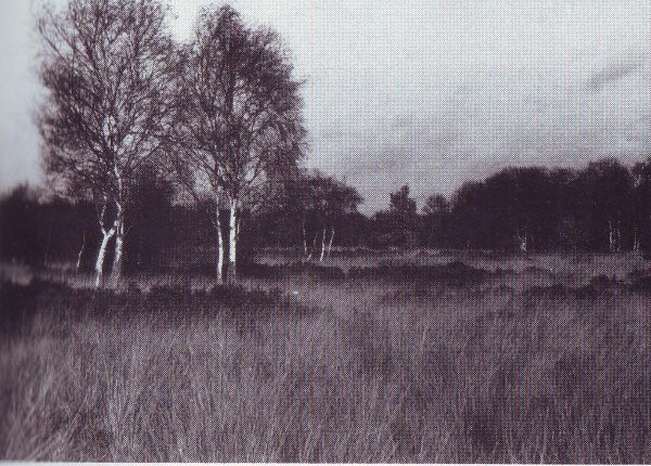
Epworth Turbary, one and a half miles along the Wroot road, is a representative fen and wet heath habitat managed as a reserve by the Lincolnshire and South Humberside Trust for Nature Conservation.
(population 2,500)
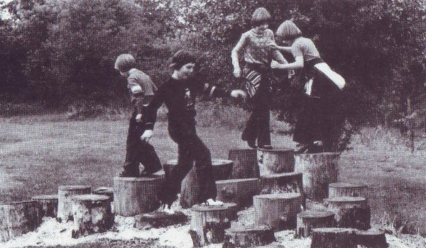
The Wesley Family
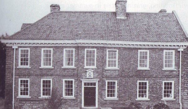
Epworth has become world-famous as the home of the Wesley family. Samuel Wesley and his wife Suzanna came to Epworth in 1696, where their sons John and Charles were born at the Old Rectory. Many visitors are attracted to Epworth to view the building, which was rebuilt after a fire in 1709 and is now the property of the World Methodist Council.
Samuel Wesley's grave is in the Parish churchyard, and the Market Cross, from the steps of which John preached, can still be seen in the Market Place. The Wesley Memorial Church erected was in 1889 in commemoration of the family.
Drainage and Reclamation
The still-extensive tract of Hatfield, Thorne, Goole and Crowle Moors is a remnant of the vast areas of moor, bog and fen which once surrounded the head of the Humber estuary and the Isle of Axholme. Drainage and clearance for agriculture from the 17th century onwards left the present moors as "islands" of raised peat bog, formerly used as turbary by the villages around.
The Isle of Axholme was bounded by rivers; the Trent to the east, the Idle (joining the Trent) on the south, and a system of interlocking channels belonging to the Idle, Torne and the Don on the west.
The River Don had two main channels, one running north from Thorne to the River Aire, and one running north-east from Dirtness and Crowle to the Trent at Adlingfleet. Part of the course of the Old River Don can be seen between the two roads in the centre of Eastoft.
The inhabitants of this fenland area lived by fishing, wildfowling, grazing cattle in summer and growing flax.
Cornelius Vermuyden, a Dutch engineer, made an agreement with Charles I in 1626 to drain "Hatfield Chase and the overflowed lands adjoining". By 1629 he had diverted the whole of the River Don into its northern channel, the discharge leading to flooding around Snaith. By limiting the Idle to its southern channel from Idle Stop, embanking the Torne as far as Althorpe and moving the outfalls of the Don and Torne upstream, Vermuyden reduced the flow of these rivers. Floods became common but the fens were changed into an essentially arable area.
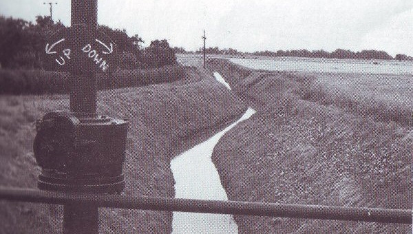
Vermuyden's drainage pattern remains but there are few floods today because of warping; the cutting in the last century of extra channels, such as the Three Rivers; and the numerous pumping stations dating from or improved following the Land Drainage Act of 1930.
Warping was a process by which land was gradually reclaimed for agricultural purposes. The marsh was protected by artificial banks and drains and then flooded through the use of sluices by the incoming tide. After the warp (silt, clay, etc.) had settled, the water was discharged. This was repeated until the land level was raised to the required height. One of the best examples of warping drains can be seen at Swinefleet.
The Isle of Axholme is referred to in the novels "Manuscript in a Red Box" and "Captain John Lister" by Rev. John A. Hamilton which are set at the time of the drainage works carried out by Vermuyden and his Dutch engineers.
Round the Villages
Adlingfleet (population 140) is near the confluence of the Rivers Trent and Ouse, which then become the Humber. It is an historic parish, mentioned in Domesday Book, and the fine church of All Saints dates from A.D. 1250.
The ancient Quaker cemetery near Manor Farm and a stone building near Church Farm, believed to have been a tithe barn, are of interest.
On the riverside, a large area of reed bed known as Blacktoft Sands, has been leased by the Royal Society for the Protection of Birds. It is a breeding ground for the bearded tit, warbler and the owl. During the spring and autumn, marsh harriers can be seen and the pink-footed geese are winter migrants to the area. Public viewing hides have been constructed but visitors should first contact the Reserve Warden - Mr. A. Grieve, "Hillcrest", Whitgift, near Goole. (Tel. Reedness 294).
Airmyn (population 880) two and a half miles north-west of Goole, is a delightful village. The red-tiled cottages line one side of the road, opposite the tree-lined bank of the River Aire.
St. David's church displays a fine stained-glass window and at the northern end of the village is an elegant stone Clock Tower, erected by the tenants in 1865 as a testimonial to the lord of the manor, George Percy, Earl of Beverley. In 1950 Brigadier Heber Percy presented the clock and the land on which it stands, to the local authority.
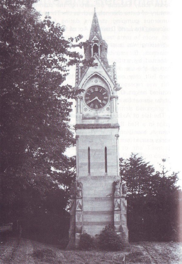
Amcotts (population 220) is a small village seven miles east of Crowle, on the western bank of the River Trent. The parish church of St. Mark was erected in 1853 on the site of a much older building.
Asselby (population 190) lies along the road from Howden to Barmby-on-the-Marsh, on the northern bank of the River Ouse. Booth is partly within the parish and partly in Howden. It was the site of the ferry crossing until Boothferry Bridge was opened in 1929. The contract for the cutting of Goole Docks was signed at the inn which stood on the opposite bank. Both the inn and the ferry house have long been demolished but the remains of the landings and the line of the earlier road can still be seen.

Knedlington is a picturesque spot with a Tudor Old Hall and a later Manor.
Barmby-on-the-Marsh (population 250), sited where the River Derwent joins the Ouse, was once a river port with wharves and a sailcloth industry. Barmby and Asselby are farming communities cut off from through traffic by the rivers on two sides.
The Yorkshire Water Authority has recently constructed a tidal barrage at the mouth of the Derwent, with lock gates to control the flow. New treatment works will take water from the river to augment existing supplies, mainly for the Hull area.
Car parking and a picnic area enables the public to see the barrage and the river bank is popular with fishermen and ramblers. Barmby is the start of an 80 mile walk which follows the Derwent to its source high on the North York Moors.
Belton (population 2,000) is a rural parish to the south of the A18 on the road to Gainsborough. Completion of the M180 motorway will give direct access from an intersection north of the village to Doncaster, Scunthorpe, the Humber Bank and the M62. During construction of the M180, aerial photography and archaeological excavation identified Romano-British settlements at Sandtoft. A full description of the survey work is contained in a booklet "Archaeology on the M180", published by Humberside County Council.
The parish church of All Saints has an interesting interior.
Substantial residential development has taken place in the village, which caters for all recreational and social activities both in the Village Hall, built in 1883, and the modern Collinson-Cooper Hall which was opened in 1968. The playing field offers facilities for sport and children's play.
Blacktoft (population 320) is a remote village on the northern bank of the River Ouse about a mile above its confluence with the Trent. The fine jetty at Blacktoft is little used now. The original landing pier was a convenient staging point for ships using the port of Goole but modern vessels, being much faster, rarely require this facility.
The small hamlets of Yokefleet and Faxfleet which lie within the parish were important settlements in medieval days.
The practice of warping was formerly carried out in the parish, and accounts for the many banks and dykes draining the extensive farmland.
Broomfleet (population 280) is an isolated community within a belt of rich farmland. It has a long and important history due to its position on the River Humber and the existence of extensive sheep-grazing pastures at Wallingfen, prior to the enclosure of land in the 18th century. The Humber Wildfowl Refuge manages a sanctuary for the protection of wild geese, which winter on the sandbanks and low-lying land.
Bubwith (population 840) stands on the east bank of the River Derwent, which is crossed by a bridge. Of Norman origin, the fine church of All Saints stands amongst the trees by the river. Built about 1170 A.D., all that remains of the Norman period is the chancel arch, a flat buttress and corbel table in the north aisle and a few fragments built into the chancel walls. Most of the present building dates from the 14th and 15th centuries.
The money for the building of the church tower and for the raising of the clerestory came from the will of Nicholas de Bubwith (Bishop of Bath and Wells from 1408 to 1424). Bishop Nicholas was born at Menthorpe and baptised at Bubwith Church.
To the south of Bubwith lie the river-bank settlements of Gunby and Breighton and the village extends eastwards to include the hamlet of Highfield and the scattered dwellings of Willitoft.
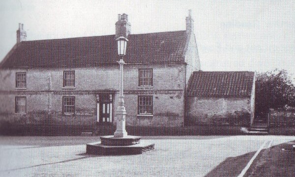
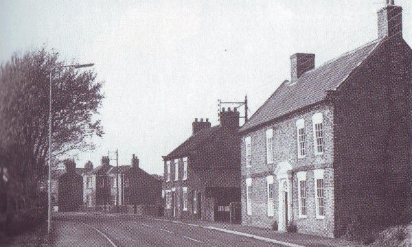
Crowle (population 3,180) together with the smaller communities of Ealand and Crowle Wharf is situated along the A161 Scunthorpe - Goole trunk road. The parish church of St. Oswald dates mainly from medieval times but has an impressive Norman doorway. Items of historic interest include the Runic stone with symbolic carvings, part of a seventh century cross originally standing in the churchyard.
Crowle was once an urban district council before being incorporated in the Isle of Axholme Rural District.
Ease of access has increased Crowle's popularity as a residential location and the North Axholme Comprehensive School serves the educational requirements of all children aged 11 to 16 in the northern part of the Isle of Axholme.
A fine modern Community Centre, opened in 1977, is the focus of social and cultural activities and visitors receive a warm welcome.
Eastoft (population 330) is a pleasantly wooded, agricultural village situated on the A161, eight miles south-east of Goole and three miles north-east of Crowle. The trees on the village green were planted to commemorate the coronation of Edward VII.
Prior to local government re-organisation, the village was administered partly from Lincolnshire and partly from Yorkshire, with the boundary being the bed of the Old River Don - the course of which was changed by the land-drainage scheme of the 17th century. The river gives its name to the River Don Hotel in the centre of the village which, like a number of the cottages, dates back to the late 18th or early 19th century.
The parish church of St. Bartholomew (designed by Pearson) was built in 1855, and there is a Primitive Methodist (1869). The original school building was demolished and a new school built in 1961. In recent years the annual Church Garden Fete has been held at the school with the aid of the Church Women's Group.
Local voluntary bodies include the Community Welfare Association and the newly-formed Women's Institute.
Eastrington (population 670) is a developing residential area to the north of Howden. The church of St. Michael is Early English and Perpendicular in style but with some traces of Norman work.
In the past there was a flourishing brick industry here and John Wesley is reputed to have stayed at nearby Portington Hall.
Eastrington has a cricket team in the Yorkshire Council and an annual Agricultural Show and Gymkhana is held on the third Saturday in June.
Ellerton (population 270) is the northernmost parish of Boothferry. The village is long and scattered, with the site of a Gilbertine Priory towards the River Derwent. Founded before 1212 A.D., it was a casualty of the dissolution of the monasteries in the 16th century. The only visible relic is some stained glass which is being moved to Bubwith church.
At Aughton, within the parish, there is an interesting church at the end of the village. It is possible that the 1460 brasses at Aughton were once in the Priory. In 1536 Robert Aske, the brother of John, lord of the manor, led the Pilgrimage of Grace against the suppression of the monasteries. The "tump" near the church is the site of the Aske family's fortified dwelling. Earthworks near the river show the site of an earlier castle.
Fockerby (population 50) lies to the south of Adlingfleet and is entirely agricultural. Fockerby Grammar School was connected with St. Catharine's College at Cambridge through endowments by Mrs. Mary Ramsden, a landowner who left large estates to the College in 1745. The school has since been to a private dwellinghouse.
Foggathorpe (population 170) lies on the main road from Selby to Market Weighton and includes the hamlets of Harlthorpe and Laytham. The village of Foggathorpe was called Fulcathorpe in the Domesday Book and was given by William the Conqueror to his standard bearer, Gilbert Tison. The moated site remains of a mansion, although the building was demolished in 1743.
Garthorpe (population 310), a small agricultural community lying to the east of the Trent, near its junction with the Ouse.
Gilberdyke (population 2,120) includes the older settlements of Staddlethorpe, Scalby, Sandholme and Hive and is sited along the main road to Hull.
Recent housing developments in the village have changed what was a brick-working parish into a commuter base for people using the adjacent rail and road facilities.
Goole Fields (population 100) is situated just to the south of Goole and consists of a cluster of houses (known as "The Barracks" by their inhabitants) and isolated farms. The early 19th century Goole Hall (in private ownership) is architecturally interesting. The former Goole windmill is a 19th century red-brick circular tower of about five storeys, covered in creeper.
Gowdall (population 240) lies on the western extremity of Boothferry, one mile from Snaith. It is an agricultural parish and the venue each July for Snaith Show.
Haldenby (population 30) comprises a number of scattered farms situated to the south-west of Fockerby. The rich warp land is highly cultivated and produces wheat and potatoes. The Haldenby family is commemorated in the name hamlet and the Elizabethan Haldenby Hall, which is used as a farmhouse.
Haxey (population 2,900) is the most southern parish in Boothferry and comprises the villages of Haxey and Westwoodside and the hamlets of Craiselound, Eastlound, High and Low Burnham.
In 1803 the parish was awarded 100 acres of turbary (fuel land) when the ancient right of cutting turf was granted to parishioners. This custom has now fallen into disuse, but "Throwing the Hood" is a most interesting local custom which still survives. This takes place annually on the afternoon of Twelfth Night, and stems from the occasion in the 13th/ 14th century when the wife of Sir John de Mowbray, squire of the parish, lost her hood whilst riding horseback. The retrieval of the Hood is preceded by a colourful ceremony and eventually it is carried to one of the local public houses where it hangs in place of honour until the day of the next Hood Game.
The parish is well endowed with religious buildings, having four Methodist chapels in addition to the parish church of St. Nicholas, which dates back to the middle of the 12th century.
The area is well known for the production of celery.
Holme-upon-Spalding Moor (population 2,060) lies snugly at the foot of an isolated hill on the main Selby - Market Weighton road. It is said to one of the largest parishes in England and includes the hamlets of Tollingham, Little End, Sand Hole, Water End, Runner End and Throlam.
A noted landmark is the church with its fine tower standing on a hill-top on the outskirts of the village. Formerly there was a beacon on this hill.
At the east end of the village is Holme Hall, long the home of the Roman Catholic Stourton family, now occupied as a convent.
A booklet containing brief facts on all the old buildings in the parish and other points of interest, was produced by a resident to commemorate Architectural Heritage Year and can be obtained locally.
A large dairy processing plant caters for the mainly agricultural area.
Hook (population 1,960) is situated on the bank of the River Ouse, about two miles north of Goole and originally owed its importance to the river ferry from Howdendyke, which became a crossing place in 1214. The parish church of St. Mary is a small Early English building with a bell turret. In a field by the church is a moat surrounding hummocks where a monastery is said to have stood.
Residential development has taken place in the village during recent years.
Hotham (population 260) lies at the foot of the Yorkshire Wolds, with the wooded park of Hotham Hall stretching between the village and North Cave. At each entrance to Hotham Park are notice boards recording the 347 miles to Ypres, and commemorating the men who never returned from service in the 1914-1918 war. The ancient church of St. Oswald was restored in the early part of this century but retains several old features, including a Norman arch and tower.
Keadby-with-Althorpe (population 1,770) is situated on the River Trent. Althorpe Parish Church of St. Oswald was built in the late 15th century, but a far older church existed on the site, for records date back to 1173.
Local facilities for indoor recreation are available at the William Stephenson Memorial Hall and at the Althorpe Working Men's Club and Institute.
Keadby is sited where the Stainforth and Keadby Canal joins the river. The canal provides for pleasure boating and visitors show interest in the jetty and locks. The extension of wharf facilities has increased shipping activities. The CEGB has a power station in the vicinity.
Kilpin (population 440) is a fairly small village in an area of well-farmed, fertile, agricultural land but the parish includes Kilpin Pike (also known as Howdendyke); Skelton (along the river bank opposite Hook); Sandhall (directly opposite Goole), and Balkholme (adjoining the Howden - Hull trunk road).
There is an expanding industrial site at Kilpin Pike, where wharfage on the river provides for the waterborne traffic to load and discharge cargoes. Convenient access can be had to the nearby M62 motorway.
Sited to the south-east of the parish is Saltmarshe Delph, a nature reserve managed by the Yorkshire Naturalist Trust.
Laxton (population 230). This pleasant village lies off the track, to the east of Kilpin. It has a 19th century Decorated Church and the chancel of an older church nearby. The parish includes Saltmarshe, where the road runs through the wooded parklands of Saltmarshe Hall, which extend along the bank of the Ouse.
The scattered dwellings of the farming community at Metham include Metham Hall, in the grounds of which is an old oak. The parish contains two moats, which were once used for drainage, fire precautions, stocking fish etc.
Luddington (population 370) lies between Eastoft and Garthorpe. The old school which was erected in 1849 has been replaced and to mark the Queen's Silver Jubilee, 25 trees were planted around the new building.
The 19th century church of St. Oswald stands on the site of an earlier building and the Catholic church of St. Joseph celebrated its centenary in 1977.
A new village hall is being financed by grants and local fund-raising events.
Newport (population 790) stands where the disused Market Weighton canal is crossed by the main road from Howden to Hull. St Stephen's church is situated midway between the villages of Newport and Gilberdyke. The growth of the village resulted from the discovery of suitable deposits for brick making which were shipped via the canal. Today the canal and the disused brick ponds are popular fishing waters.
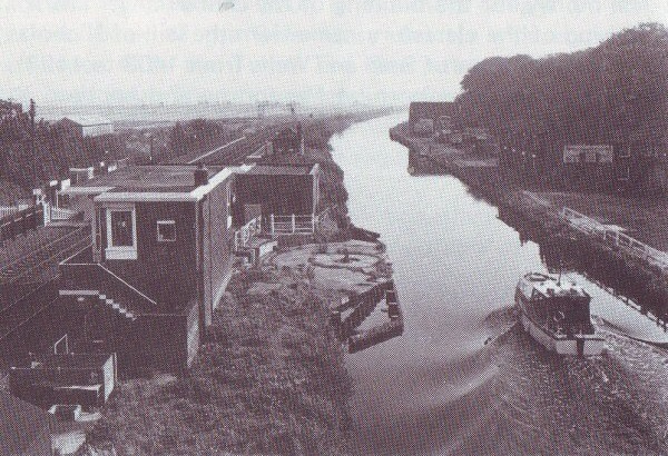
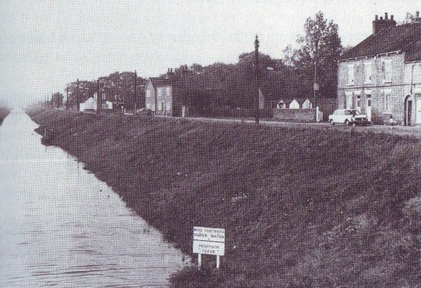
North Cave (population 1,530). A large village developing rapidly as a residential area. Part of the village known as Nordham, is prettily situated on the Mill Beck, and is included in a conservation area. The handsome church of All Saints has monuments to the former lords of the manor, the Metham family.
Ousefleet (population 100) Lying at the confluence of the Rivers Ouse and Trent, about seven miles from Goole, the village is the site of an ancient manor house known as Hall Garth, of which some ruins remain. The Manor was the ancestral home of the Usflet family.
Owston Ferry (population 960) The village lies on the west bank of the River Trent, midway between the bridges at Keadby and Gainsborough. Before the development of the railway it was the centre of an extensive river trade. Now, its only interest on the river is the "Eagre" which is seen here at its This form of tidal wave can generally be viewed on several occasions but the best time is usually at the beginning of August.
The parish church of St. Martin is one of the oldest and most picturesque in the area.
Another point of interest is the steam engine pumping house. This can viewed by the general public and enquiries should made in the village.
Local recreation is catered for at the Coronation Hall built by public subscription, and the public recreational field owned by the parish council.
Pollington (population 630) is another of the agricultural villages on the western edge of Boothferry. It was originally the settlement of an Anglian family and human remains have found dating back to the 4th or 5th century.
The Victorian church (1854) was by William Butterfield.
H.M.S. Pollington, one of the Royal Navy's fishery protection vessels, has been formally adopted by the Borough Council. Boothferry has a special link with this Coniston class former minesweeper, some vessels being built at Goole shipyard.
At Pollington are boreholes of the Yorkshire Water Authority and light industry is developing on the old airfield.
Rawcliffe (population 2,300) is divided into two villages which are 1½ miles apart. The old village of Rawcliffe is pleasantly situated beside the River Aire and the houses surround the village green which is bordered with fine chestnut trees.
In the churchyard of St. James, rebuilt in 1842 in the Early English style, is the grave of "Jemmy Hirst". Jemmy was a local eccentric who lived at the time of King George III. His favourite sports were hunting on his pet bull and shooting with his dog and pig.
Rawcliffe Hall Hospital is a large country house, now catering for the needs of the mentally handicapped, and a modem Training Centre has been built to provide schooling for handicapped young people.
Nearby is Parklands, a purpose-built old people's home.
Rawcliffe Bridge lies alongside the Leeds Canal and the Dutch River and is an industrial area. There are factory sites which make good use of the excellent transport facilities by rail and water and the nearby intersection of the M18 / M62 motorways facilitates swift movement by road.
Reedness (population 300) A pleasantly situated village adjoining Whitgift on the banks of the River Ouse, the parish includes the hamlet of Little Reedness.
The village was originally owned by Selby Abbey and the monks built a sea wall between the years 1127 and 1137 to protect their lands. Whitgift Clough is to be the earliest sluice gate in the country.
Spaldington (population 140) Four miles north of Howden, Spaldington is an isolated hamlet with extensive commonland where the R. 100 airship was constructed during the 1920s.
The local authority is proposing to construct a golf course on Brind Common.
Swinefleet (population 850) on the banks of the Ouse to the south of Goole, the waterside village of Swinefleet is believed to have been an ancient settlement of King Sweyn, who is thought to have camped here during 1013. The parish is intensively farmed and the rich warp land produces crops of wheat, corn, oats, barley, and potatoes.
St. Margaret's is an ancient brick-built church with a bell turret.
West Butterwick (population 700) is situated on the west side of the River Trent. The parish church of St. Mary was built in 1841 and there is also a Methodist Chapel.
Whitgift (population 140) This picturesque village lies on one side of the road, opposite the river bank adjoining Reedness. The church of St. Mary Magdalene serves the parishes of Reedness, Whitgift and Ousefleet and is well known to sailors on passing ships as well as travellers by road, because the face of the church clock shows the figure "xiii" instead of "xii".
Whitgift Hall is a handsome Elizabethan building about half a mile east of the village.
The local Marshland choir draws its members from the parishes of Whitgift, Ousefleet, Reedness and Adlingfleet. Under the leadership of Mr. Frank Ella, rehearsals of the choir are held at Whitgift.
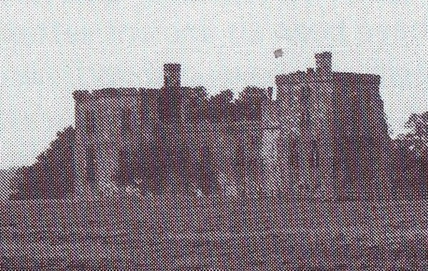

Wressle (population 230) Sited to the south of Bubwith, Wressle is noted for its castle which is claimed to the only fortified building still standing in East Yorkshire. Now a private house it was built in the 14th century by one of the great Percy family. It was made uninhabitable at the end of the Civil War and almost destroyed by fire in 1796, but the south side of the original quadrangle and two towers remain.
A new feature of the village is the recently completed village hall.
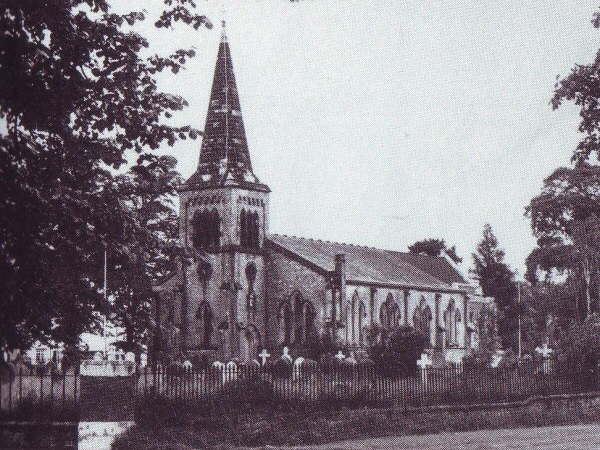
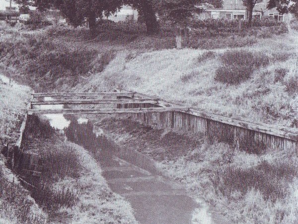
Wroot (population 360) is an isolated agricultural village in the south-west corner of Boothferry. Its church, dedicated to St. Pancras, was rebuilt after a fire at the original 14th century church. Methodism has connections with the village through the old rectory and a chapel.
The local school was provided by Travis in 1874 and bears his name. Wroot Feast is combined with the school sports day.
Recreation
Both privately owned and local authority facilities provide for varied interests.
The range of sports covers archery, athletics, bowls, cricket, football, horse-riding, judo, rugby, sailing, squash, swimming, tennis and weight-lifting.
Goole has a successful football team in the Northern Premier which plays on the Council's Victoria Pleasure Ground. The football pitch forms part of a small sports complex which includes an athletic track and sports hall.
Leisure and sports centres are scheduled for development at Goole and Epworth. During the winter season, indoor recreational facilities are available at the Baths Hall, Goole, where the Council has provided a Sauna and Solarium Suite.
There are a number of gardens, parks and amenity areas.
Village life often centres around the community hall, which provides a social meeting place. Some also provide playing fields for sport and children's play.
As may be expected in a largely rural area, a popular feature of local life in the summer months are the agricultural shows and gymkanas, village feasts and sports.
Water-based recreational activities are expanded on the canals and rivers, in particular the Derwent upstream of the Barmby barrage.
Nature reserves managed by local branches of the County Naturalists' Trusts include Saltmarshe Pond, Epworth and Haxey Turbaries, Crowle Waste and Blacktoft Sands.
Stretches of the disused Axholme Joint Railway at Haxey and Epworth and the Hull-Barnsley line at Eastrington have been acquired by the local authority for the protection and development of amenity, for conservation, and for public recreation and enjoyment.
Recently work has commenced on the development of an 18-hole golf course to the north of Howden, to be known as "The Boothferry (Spaldington) Golf Course".
Many clubs and societies cater for every interest in music, drama, dance, film, crafts and heritage. A wide variety of amateur and professional events are promoted by local and regional organisations.
Touring exhibitions are frequently displayed in Goole Library and the Lincolnshire and Humberside Arts mobile gallery regularly visits venues within Boothferry.
The Garside local history collection at Goole Library is of particular interest to anyone wishing to learn more about the background and development of the area.
Epworth Old Rectory is open to visitors who are attracted by its connections with the Wesley family.
The Sandtoft Transport Centre is a local collection of old buses, commercial vehicles and cars.
There is a cinema in Goole and social Clubs and Institutes offer entertainment for registered members.
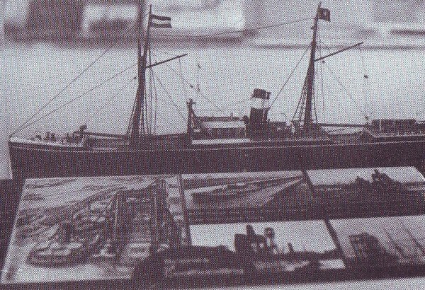
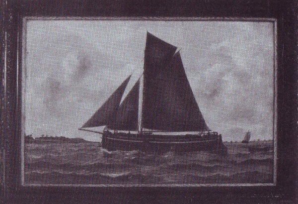
Reuben Chappell (1870-1940) was a Goole born painter of the local keels, sloops and steamers which sailed to the Continental ports. Largely self-taught, his individual style did not gain recognition until some years after his death. Some of his paintings are on display at Goole Library.
Industry
The Council is keen to see new industrial and commercial developments take advantage of the expanding communications network which has made Boothferry the Gateway to Humberside
- Road - M62, M18 and M180.
- Rail - direct links to London, Hull, Doncaster, and other cities.
- Water - four major waterways and direct sea links from Goole to European and other ports
Part of the Borough lies within an Intermediate Area for government financial assistance with a smaller section of the Borough possessing Development Area Status. There are a number of industrial estates with land available which lie close to the motorway system and interchange points: eg. at Goole, Howden, Gilberdyke and North Cave. The Council has also developed an industrial estate close to the M180 at Sandoft.
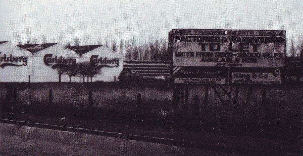
The Borough's industrial structure is dominated by the port of Goole, but recently a number of well-known firms have come to other parts of the area, including Tate & Lyle, Smith and Nephew, and Celcon. Carlsberg, Renault and Burton Tailoring amongst others, are located in Goole itself.
There is adequate labour available with generally good relations. Housing accommodation is available at prices below the national average and the Council is always prepared to consider assistance to firms in this direction.
General Information
Statistics
- Area - 159,178 acres
- Population - 60,799
- Electorate - 45,246
- Parishes - 44
- Rateable Value - £5,291,875
- Penny Rate Product (inclusive) - £100,578
Local Administration
Boothferry Borough Council comprises 35 members who represent the people of the former Goole Borough and the Goole, Howden and Isle of Axholme Rural Districts.
Meetings of the Council and its three standing committees are held in the Council Chamber, Stanhope Street, Goole. Further details can obtained from the Chief Executive's Department.
Principal Council Office
Stanhope Street, Goole DN14 5BG Tel. (0405) 5141
- Chief Executive and Borough Secretary - J.W. Barber, D.M.A., M.I.L.G.A., F.B.I.M.
- Borough Treasurer - A. Atkin, IPFA, FRVA
Carlisle Street, Goole DN14 5DS Tel. (0405) 5141
- Chief Health and Housing Officer - D.H. Hibbert, M.E.H.A., M.I.H., M.R.S.H.
- Borough Engineer and Surveyor - A. Johnson, F.F.S., M.C.S.I., A.M.C.T., M.R.S.H.
41 Hailgate, Howden, DN14 7SL Tel. (0430) 30286
- Chief Planning Officer - D.L. Learoyd, M.R.T.P.I.
Early Closing Days
- Goole - Thursday
- Crowle - Saturday
- Epworth - Wednesday
- Howden - Wednesday
- Snaith - Tuesday
Market Days
- Goole - Wednesday and Saturday, with a limited opening on Friday.
Members of Parliament
- Goole Constituency - Dr. E.I. Marshall (Lab.)
- Howden Constituency - Sir Paul Bryan, D.S.O., M.C. (Cons.)
- Gainsborough Constituency - Marcus Kimball (Cons.)